Posted on

September 2009 Trip – Leg Three

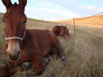
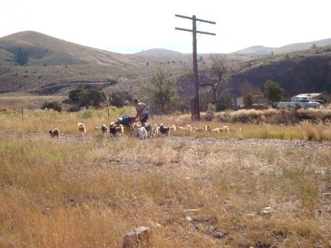
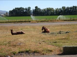
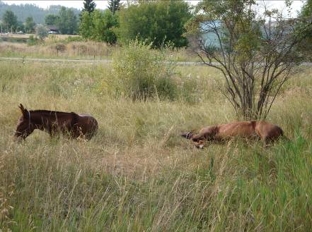
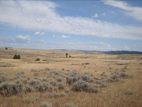
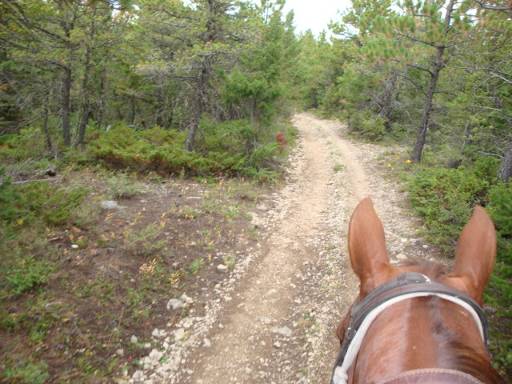
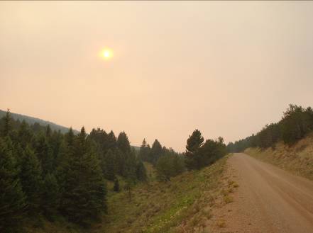
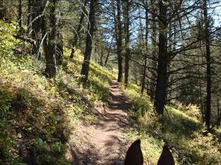
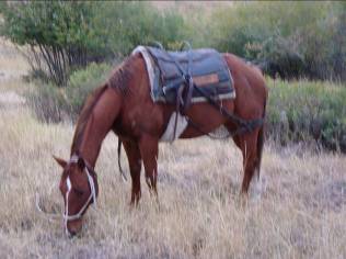
Little Bentley was so fun he deserves a second picture. From Nate & Brittany’s I headed south out of Bozeman looking to go over the mountain to Mystic Lake. I wanted to skirt Bozeman Pass. When I did get to the trail head I found it was VERY popular with hikers and mountain bikers, and most of them had their dogs. I had picked up a stray that I had to put the run on and a couple of older ladies gave me this, “Boy you’re mean” look. About 6 miles up I got to a spur trail that was more my style.

sep3_1sep3_2


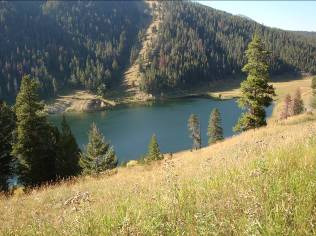
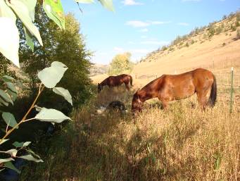
Mystic Lake really is a pretty lake. There is a Forest Service cabin there that is rentable, but a fair hike to get there. This was the beginning of an interesting couple of days. I was at Mystic about 3:00 and rode til about 6:00 just trying to find trails. No trail markers had anything like what my map said. I followed a logging road until it played out, circled back to Mystic, took another unmarked trail and decided it was wrong, headed back to Mystic, and finally took a trail to the north side of Mystic and camped for the night. Three hours riding and hadn’t got anywhere. There was one trail left that said “Bear Lakes TR 53 – 4 miles” that I decided I would try in the morning. No TR 53 on my map, but it headed west.


The next morning found me about a mile up the Bear Lakes trail, boxed in by downed timber, too high to jump, no way around to bush-wack, but back. “I don’t want to go back!” So with my dull ax I had forgotten to sharpen, I spent time finding the most rotten log to hack through. I still had trouble convincing Betsy she could jump it. She thought rearing was more appropriate until I adjusted her neck with Hannah’s lead rope. Jumping wasn’t so bad after all.


 sep3_3


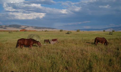
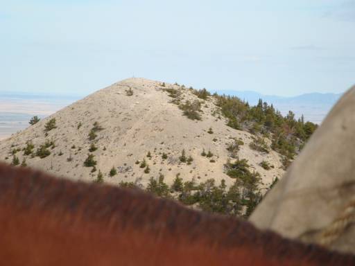
After two more log jams we could brush-pop around, and a super steep rocky, eroded trail off the top that I walked off of, we made it to Bear Lakes. This is the northern Bear Lake. The southern lake was a moss covered green, slimy pond. The amazing thing through here was that it is all accessible by 4-wheelers and is a horrendously eroded, torn-up mess! We found ourselves skirting the trail because it was so bad. But I figured if there was that kind of access, then there had to be a way out.


I started out heading north for about a mile and decided that was wrong so I went back to the lakes and found a trail that headed west. “West is good.” Trouble was it ended at a camp site in a half mile or so. No other options, but Mystic Lake, so we went north again only to find a trail that said “Loop Trail” “Great! Now we get to ride in circles!” But my map showed an unmarked looped trail with another trail coming in from the north. So off we go, north on the loop.

sep3_4


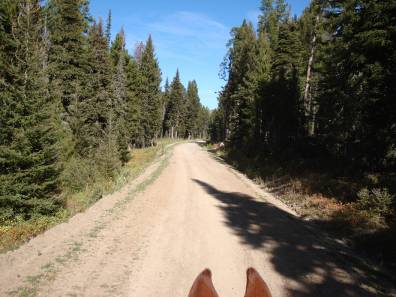
After riding the loop for several hours we came to an intersection of trails; we were riding west at the time and the trail “Teed” into a north – south trail. By my map, the south trail (unmarked) would have looped back to where I had started, so I went north. After several more miles we came across a sign that said “Bear Canyon.”; another mile, another sign, “Bear Canyon.” “I don’t want Bear Canyon, because that leads us back to Bozeman!” So, back south I go, pick up the other south-bound trail, which leads us by some old homestead sites, up a long, tough grade, and “Voila! Trail Creek Road.”

sep3_5


Now I know where I am! (Or so I thought) So, off we go, heading south, heading for Livingston. We passed a Forest Service mile marker that said “4” so I figured I was four miles down Trail Creek Road; further north than I wanted, but good to go. Three miles down the road I came to the Trail Creek Ranger Station. Trail Creek Ranger Station is not on Trail Creek Road! Come to find out, it is on Goose Creek Road and Trail Creek Road is 7 miles back north! So 7 miles back north we go to finally camp a half mile from Trail Creek Road. Also, Goose Creek Road is not on my map. I have decided I don’t like my map any more.

Short story long; I had planned to be in Livingston Saturday afternoon to see sister Carol and Tom before their store closed. 10:00 am Monday morning I rode in.

sep3_6


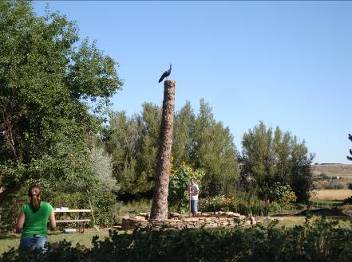
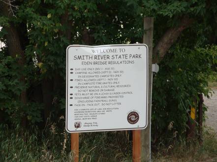
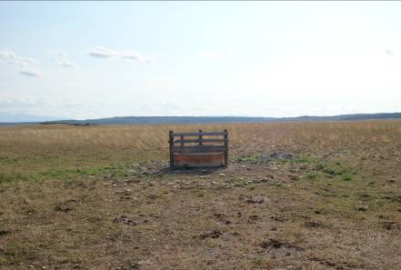
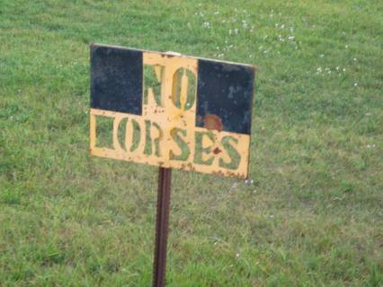
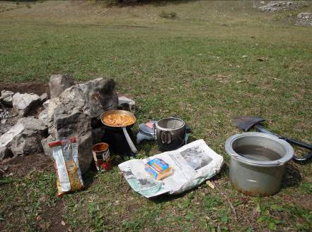
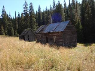
I’m sorry this photo didn’t turn out better than it did, but I had never heard of Storrs. The sign reads:


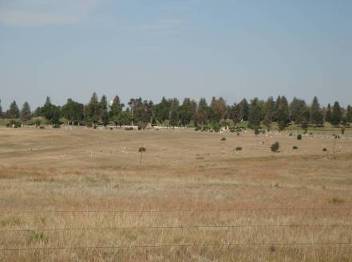
This was the site of the town of Storrs from 1902 to 1910

Storrs was a model coal company town laid out in blocks with

painted houses having running water and electricity. (1904-1910) There

was also a hotel, boarding houses, store and fire station.

The town was built by the Anaconda Copper Mining Company

for the workers who labored in the coke production plant

and coal mines. In 1908 the operation shut down. The plant

burned down under mysterious circumstances. From 1899 to

1918 the Turkey Trail Railroad serviced this area. The ruins

of 50 coke ovens, the coal wash plant, foundations,

the motel foundation and a fire hydrant can be seen

from the road.

sep3_7


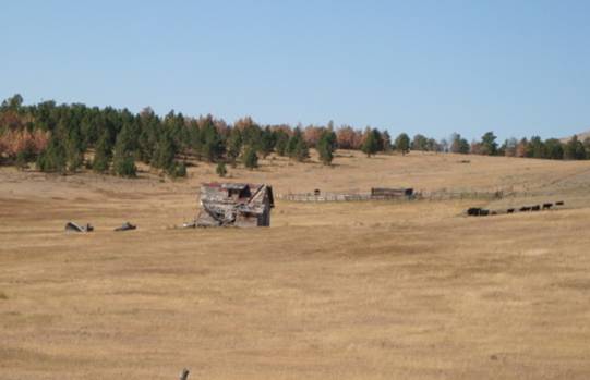
The photo to the right is part of the remnants of the ovens referred to in the sign.

sep3_8


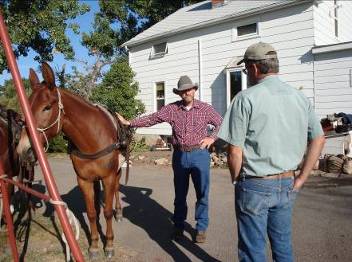
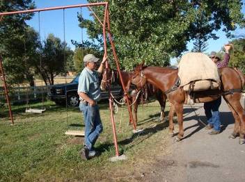
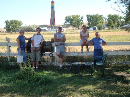
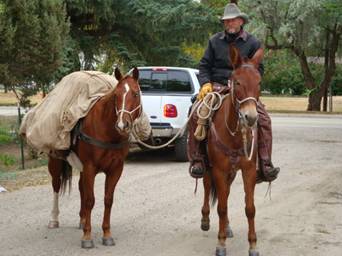
I did eventually make it to Tom & Carol’s Way Out West store where I had a delightful 5 hour visit. Hannah and Betsy were crowd pleasers. I had stopped to pick up a real map at the Forest Service Office down the street where I heard that snow was predicted Tuesday night. Carol graciously outfitted me with wool socks and tee-shirt to help avert the oncoming storm. Two days later they were GREATLY appreciated! Thanks Carol!

sep3_9


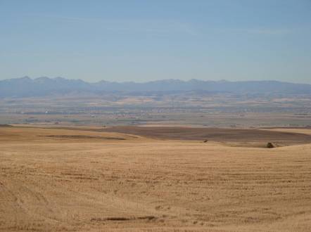
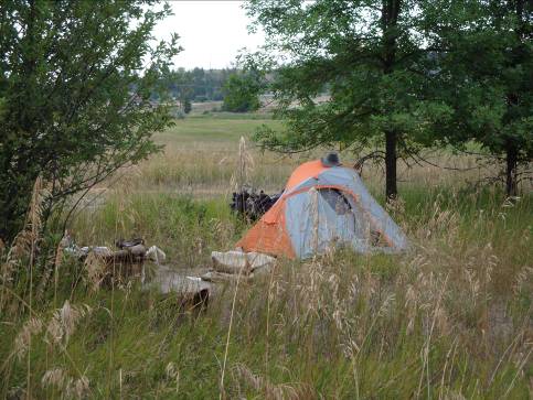
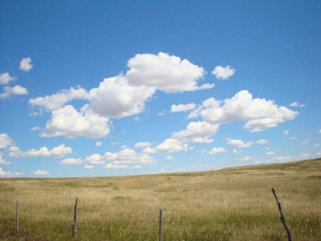
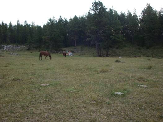
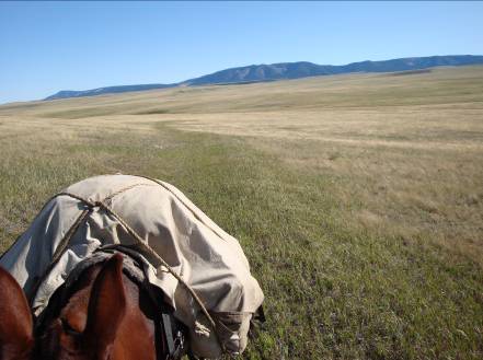
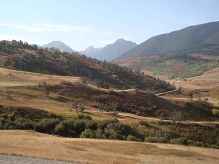
The trip from Livingston to McLeod was in comfortable, beautiful fall weather; some colors in the trees were starting to show. We found a little spot behind an irrigation ditch with nice grass; trees for some shade and a little off the beaten path. It was only 3:00 in the afternoon, but this was a nice spot. Rest is always welcome; blue skies, warm breeze, good feed.

sep3_11sep3_10


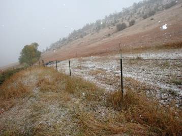
Wednesday morning the rain set in, which quickly turned to snow. “Don’t like the weather in Montana, just wait!”

sep3_12


I had planned to head south, deeper into the Beartooth Mountains, but instead we headed north towards Big Timber to ride around the bulk of the storm.

We had camped at the base of the mountains where the main storm was and by about 5 miles we were into just the rain and wind – cold wind.


sep3_13


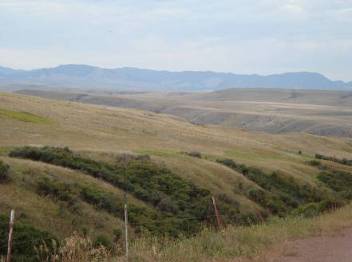
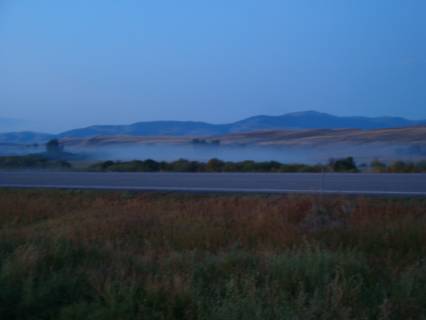
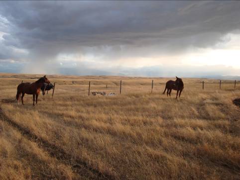
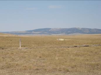
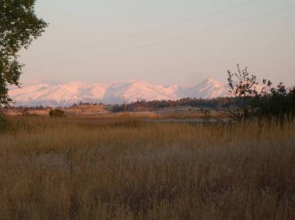
The Crazy Mountains were beautiful after the clouds lifted off.

sep3_14


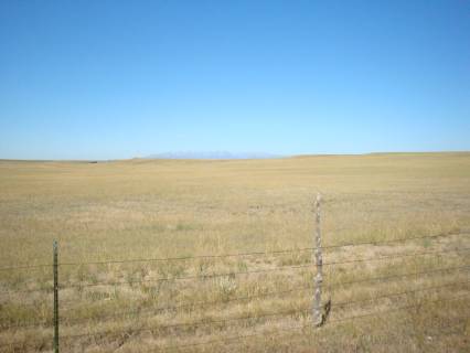
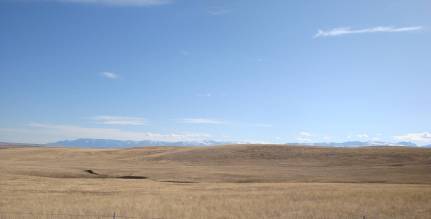
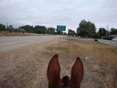
After Big Timber, down Bridger Creek Road and headed for Absarokee, we finally saw the Beartooth Mountains that we can see from Joliet. This was when I really felt like we were getting close to home. While riding Bridger Creek Road I was told of another snow storm coming that was predicted to drop a foot of new snow by Sunday evening. (Now Friday)

sep3_15


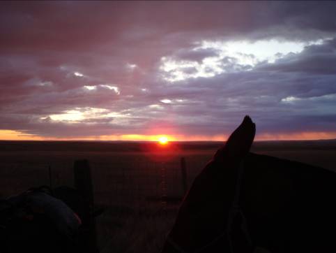
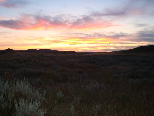
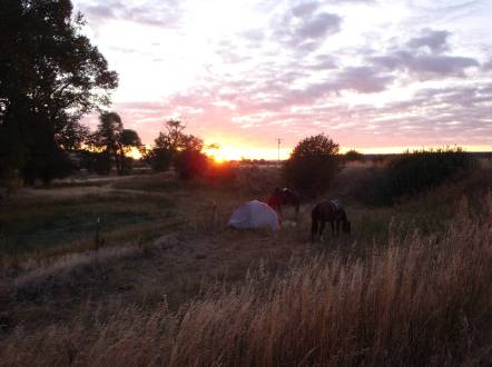
Saturday morning we awoke to yet another beautiful sunrise.


sep3_16


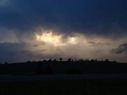
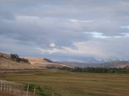
But by Saturday afternoon the mountains were starting to disappear under the impending storm.

sep3_17


By Sunday morning, camped at Cooney Dam Reservoir, the Beartooths were no longer visible, light snow was in the air and the wind was cold.

sep3_18


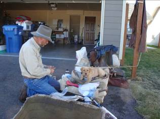
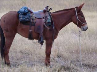
This was the morning of “lasts”. It was actually a bit gut wrenching for me as I took last pictures, fed the girls their last cake on the trail, saddled up for the last time and gave them each a hug for their companionship. They are sweethearts.

sep_oksep3_19


As all things must come to an end, we made it back home; 650 miles, 36 days, worn out horse shoes, square toed hooves and a few dings, but a memorable time, a new outlook on life and a desire to go again.

Sorry Kawasaki, you might be for sale!

sep3_20


sep3_21


Thanks all for traveling the miles with me!


Dave


Posted on

September 2009 Trip – Leg Two

My father planted this evergreen tree when I was young and I remember him nurturing it, split top and all, until it became quite a beautiful tree. It winter killed several years ago and Dan limbed it and topped it and said he was going to carve it into a totem pole and at the top was going to be a peacock. That morning, as we were adding to the flower bed at its base, one of their young peacock males flew to the top and perched there while the work below ensued.   “See, there’s going to be a peacock at the top” Dan says with a wry grin.

sep2_1sep2_2


Monday morning, September 14th, I packed up and headed on leg two towards Bozeman where our daughter Janelle and son Nate (Brittany) live. Fresh supplies are packed up and after climbing on the scales at my sister Katy’s kennel I found that I had only lost 5lbs. so far.

sep2_3sep2_4


I rode past the Highland cemetery where my folks are buried in the Veterans section (the white markers in front). About 10 miles out of town Hannah came up lame and after checking her over I decided to head back to Great Falls and find a vet for a check over. She seemed to favor her right hind leg and I thought maybe she had stifled herself. We walked back about three miles when I could tell she was limbering back up. I concluded that she had muscle cramps and was working them out so we headed back south.

That night at camp they were both eager to bed down for more rest. Neither seemed to overly eager to be on the trail and it had been kind of a ho-hum day anyway. So we stopped early, rested long and ate well.

 sep2_5sep2_6


This night brought another beautiful sunset and a gorgeous night under the stars.

sep2_7


Headed south we were viewing yet another mountain range south of Great Falls known as The Cascades.


 sep2_8


No western landscape is complete without a windmill.

sep2_9


 We soon crossed the Smith River, well known as perhaps the most popular scenic river to float in Montana. It is so popular that reservations have to be made well in advance and numbers of floaters are limited.

sep2_10


 sep2_11


We were soon into more wide open cattle and sheep country as we headed down the Milligan Route towards White Sulphur Springs. This was a particularly calm day and we put up with long dry stretches filled with flying ants for hours. In the planning stages of the trip, this was the longest stretch that concerned me because of the lack of natural water sources. It was 20 miles between creek or river crossings. We found one spring-fed stock water tank at about 18 miles after we crossed the Smith River that was a very welcome relief. Hannah and Betsy wee perkier, but days like this day turned out to be tests of endurance, physically and mentally.

sep2_12


I ended up taking numbers of pictures of old farmsteads and homesteads and tried to envision the dreams, families and lives that fought for their existence in some of these remote regions of Montana.

sep2_13


The map shows a town called Lingshire, but this old Post Office building is all that remains.

sep2_14


Fort Logan is another lingering memory of glory days long past; built to protect miners during the gold rush days, it now remains, privately owned, well kept, but without a marker, so as to avoid the hassle of tourists.

sep2_15


After the long dry stretch through the Milligan route, we rode over the crest of a hill, 9 miles out of White Sulphur Springs, to this little oasis. We had traveled close to 30 miles, 11 miles of pavement, hot sun, no breeze, poor ditch banks, and 70 mph traffic and were at the end of our endurance when this showed up. What a welcome sight! Knee high grass, alfalfa and thistle; both Betsy and Hannah seemed to like Canadian Thistle. We were camped across from Steve & Maggie Buckingham, and Steve met me at the road the next morning with hot coffee and an invitation to a hot breakfast, so not only did the girls dine, but so did I.

sep2_16


That night I rolled up in a sheet of plastic to the patter of rain after watching a mesmerizing lightning show. By morning there were the cries of Sand-hill Cranes, fog on the Smith River and heavy dew. What a beautiful morning!

sep2_17sep2_18


As we headed south, out of White Sulphur, towards Bozeman, we rode sparse, sagebrush, dry country. It was 23 miles to the town of Sixteen from where we camped the night before.

We saw what looked like two dust devils in the distance, but it turned out to be two large 4-wheel drive tractors scratching out a living.

sep2_19sep2_20


We did finally see signs of habitation at the town of Sixteen; two homes. This was the home of Mike & Ingrid Eckberg and their neighbor, Bill. Theirs was the only homes since highway 12, which was eighteen miles north. Ingrid goes to Ringling twice a month to get the mail and drives 4 miles north to a high spot to get cell phone service. And I can assure you that Ingrid makes a killer club sandwich and bacon & egg breakfast!

sep2_21|


Bill has lived here all his life and is surrounded by man’s best friends, about 50 of them. 30 accompany him everywhere he goes, even when he rode with me across 10 miles of mountain trails to show me the way to Maudlow (and back by himself). Bill was the only one to ride with me for any portion of the ride, and this with severe arthritic pain in his hips. This was a momentous day for me and a new friend I shall never forget! Thanks Bill.

sep2_22


Every morning was cake time and both girls knew it. Every morning I was greeted with “Glad to see you’re up. Where’s breakfast!” This morning, on the middle fork of Sixteen Mile Creek, I was slow getting there so they came rousting me out. The frost was pretty heavy so we waited for the sun and listened to the bull elk bugle.

sep2_23sep2_24


After 9 days from Great Falls we rode into the Gallatin Valley’s Bozeman.

Here we spent two days resting and refueling the mind and body.   Nate & Brittany’s little puppy, Bentley and I had great days lounging while Brittany attended classes and Nate organized his roofing crews. We had a nice dinner out to celebrate their first anniversary and restocked supplies once again, with Bentley’s supervision of course.

sep2_25sep2_26


Last leg left – heading back to Joliet.

sep2_27


Posted on

September 2009 Trip – Leg One

September Notice

The first of September (2009) marks the fulfillment of 30 years in the wheelwright trade when early September, 1979, I joined Rick Bischoff in his vision of a buggy shop here in Joliet, Montana. Much has come and gone since then; Old Timers have moved on and new aspiring teamsters have picked up the lines.

Many times I have heard, and felt, the notion, “I was born a hundred years too late.” The “good old days” are enamored by those who look back admiringly from the comforts of our current lives, and looked upon with mixed feelings by those who remember the hard times.

All this to say that I am going to be out of the shop for the month of September (2009), and even possibly a week or two of October, to experience a taste of days gone by. I am going on about a 600 mile horseback ride/pack trip to taste a bit of what our forefathers lived. I plan to leave the 30th of August and should return sometime in early October.

The drawback to being a family owned operation is that when I leave, things pretty much stop. Diane will be here to answer the phone as much as possible and even help you with your orders, but things will be operated on the lean side. I know this will be an inconvenience for some, but understood by most. Our personal number will be available through that time and she will monitor the email boxes as best as she can. You can reach her at 406-591-3573.

Once I get back in the shop we will begin our 31st year and I look forward to what we have in store. Times have changed since our forefathers opened up this country and times are changing all around us today, so follow your dreams, overcome your fears and appreciate your friends.

See ya when I get back!

Dave

October Note

I made it!! 650 miles and 36 days later I rode back into Joliet. I had plans of making it an even 40 days, but rumors of snow storms made me re-route my trip and head ‘er for home. Things went pretty much as hoped for, and planned. I left Joliet Aug 30th and rode back into town October 4th. I started out riding Hannah, a 7 yr. qtr-horse, a Hancock blood-line mare, who is cutting horse fast on her feet when she wants to be. I packed a 10 yr old mule, Betsy, who would love you to death if you showed that you loved her; which I did. 2 ½ weeks into the trip I switched places and rode Betsy and packed Hannah.

I was amazed at the bond that was generated between the three of us. Day after day of routines soon became habits of conduct. Saddles and packs were put on and lead ropes just dangled as the girls patiently waited their loads. Long, hot, dry days were pleasantly interrupted by patches of bright green brome grass and stock tanks; stock tanks and reservoirs became welcome sights. Probably half the nights were enjoyed out under the stars enjoying the beauties of the heavens while frost, rain and snow chilled my fingers and toes on others.

I was amazed at the noisiness of mankind each time we entered a new town. I never realized how noisy mufflers were and how loud tires were on pavement until spending numbers of days where all we saw or heard were coyotes and hawks. We traveled the grasslands, farmlands, mountain meadows and pine forests. We were forced to ride maybe 60 or 70 miles of paved roads which were hair-raising with 70 mph traffic and no ditch banks or right-of-ways at times. Gravel roads weren’t as bad, but hard on horseshoes, so we sought out cow-paths, ditches and soft shoulders wherever possible. Often times, through big ranch country, we could travel draw to draw, gate to gate, cattle-guard to cattle-guard and high-mountain trails, and reminisce that this is how it would have been for the early settlers and mountain men as we rode with no roads in sight. 100 year old wagon trails were a special treat, and I was amazed several times at the work involved to traverse creeks, draws and muddy hills. What a hearty breed our forefathers were! What a contrast to the “take care of me” mentality prevalent today.

I can’t recall how often I heard, “I would love to do something like that!” It made me realize that the responsibilities of our high pressure lives keep some of us from living our dreams, (though I did meet several who were living their dreams). People all along the ride became monumental memories to me; people who didn’t know me from Adam, who cooked a meal for me, offered the girls and me a drink, gave us directions and stopped to hear what I was doing. A very special man named Bill, hampered with painful arthritis, rode 10 miles across mountain trails to show us the way, and then 10 miles back home by his self. That was the living example of the “extra mile” and it touched my heart.

I was told before I left that I would be amazed at the people I would meet and that when I got back I would be a different person. I didn’t understand then, but I do more-so now. Where this will lead from here I am not sure, but I know I have discovered something that I love.

Dave


Leg One

Headed out of Joliet on Aug 30th, 2009

sep1_1


And leaving Carbon County

sep1_2


This is our first night’s camp at Fireman’s Point fishing access west of Columbus. After 23 miles the girls are tired.

sep1_3sep1_4


This became a contrast of life styles;

an awakening of the difference

between necessity and luxury. My

first camp was just below this mansion.

sep1_5


Our second night was under unsettled skies and wide open rangelands.

sep1_6


But this made for a beautiful morning sunrise that turned into rain, so we packed up wet and rode in the rain for a couple of hours.

sep1_7


Once we headed north of Reed Point we were into grasslands, cow country and brilliant blue skies.

sep1_8


Stock tanks and reservoirs became sought after water holes. The first two weeks gave us day after day in the 90ºrange where any sort of breeze was more than welcome.

sep1_9


After we lost sight of the Beartooth Mountain Range, the next mountain range in view was the Crazies, to the west.

sep1_10


The fluffy, cotton clouds drifted through the bright blue big sky country.

sep1_11


Since we had no one around to take our pictures, I did some self portraits.

sep1_12


Some of the colorful skies were just breath taking. This was on the Ed Bredding place where I was given the typical Montana rancher style directions, “Keep heading west. You can’t miss it.”

sep1_13


What Ed was referring to was this 100 year plus old wagon trail that ran through his place. “Cross the reservoir, past the three corner gate, and head west. You can’t miss it.” And by golly, there is was!

sep1_14


I liked this photo ‘cuz this showed cowboy style cattle guards. I actually began to think I hated cattle guards, because every time I had to open a gate, but I began to realize it gave me a chance to get off and stretch. I wouldn’t know how many hundreds of gates I opened. One thing our forefathers didn’t have to do is deal with fences and gates. Often times I was within a few feet of water, but was fenced out.

sep1_15


I wouldn’t have thought I would see this in Montana, much less at a fairground setting, but that’s what I rode into in Harlowton.

sep1_16


Fine then, I’ll go where there are no motorized vehicles

allowed, which was just across the road.

sep1_sign


From Harlowton I headed north to the next set of mountains, which were a spur of the Little Belts, just west of Judith Gap, and thankfully there were more stock tanks on the way. This ended up maybe being one of the longest days we rode, crowding 30 miles. Most days we traveled from 8:00 to 6:00, but this day we didn’t get to a camp-able sight til after 8:00.

sep1_17


We camped in the Little Belts over the Labor Day weekend and spent our first lay-over rest day here.

sep1_18


This was also my first, and only, hot, camp-cooked meal I made on the whole trip. I had the capabilities to cook, but ended up eating out of cans and wrappers. It just wasn’t worth the effort for clean-up when water wasn’t always plentiful. This was a can of chili with elbow macaroni and cheese added. I called it chili-goulash soup and it was great! At this camp we had to walk ¾ of a mile each way to get water. We walked it four times. This was on Roberts Creek, but it was dry.sep1_19


This was on top of the Little Belts looking north. I wasn’t supposed to be here, but that’s what you get for taking the wrong trail. Just an extra three hours of riding. We actually rode to the peak, where there is a survey post, and the end of the trail. This is the west “sister” of two peaks known as “The twin sisters.” As we navigated rocky slides and disappearing trails, I realized that if anything happened here – nobody would know where to look. This is how people disappeared.

sep1_20


This was the right trail that got us off the mountain.sep1_20


This is north of the Little Belts, looking back south, and if you look at the mountain sky-line, from right to left, you will notice a double-humped pair of peaks about an inch in from the edge. The first peak is the west peak of the twin sisters, where I was the day before, pictured above.

sep1_21


This is also some of the beautiful ranch country we were able to ride through, courtesy of Paul and Janet Wertheimer of Hobson, MT. We met as they were gathering and weighing calves.

Through the Wertheimer Ranch, I picked up another old wagon trail that took me clear into Utica, an old tromping ground of Charles M Russell. On the skyline you can see the Highwood Mountains to the left and two buttes known as Round Butte and Square Butte.

sep1_22


Headed west from Utica I ran into some real dense smoke from a fire clear over by Helena. Not having a radio I had no idea what I was riding in to or how far away the fire was at the time. The sun was just barely peeking through.

sep1_23


Some of our camps spots were less than ideal, but always sufficed. This was on the dry, rocky creek bottom of Dry Wolf Creek.

sep1_24


After about 280 miles of riding I arrived at Great Falls , on day 14, to my brother Dan’s place with wife Nora (left), son Robert, Dan, daughter Laura and my wife Diane (right). They had no clue I was coming until about two hours before I got there. So Dan and Robert quickly patched holes in the fences while Nora and Laura got a water tub ready and made us feel right at home. Leg one of the trip and another day of rest, MUCH appreciated by all. We all enjoyed a 50th birthday party potluck at the neighbor Bob’s, where I ate way too much and I paid for dearly the next day. My body violently rejected the sudden rich diet after two weeks of surviving.

sep1_25